Mexico TOPO MAP for GARMIN GPS
MAP E32 is a topographical map of Mexico for Garmin GPS devices, specially designed for doing routes on ATVs, enduro, off-roading, 4x4, mountain biking, hiking, etc. In a nutshell, for any outdoor activity.
Highways, roads, dirt roads, trails, railroad tracks, cities, towns, airports, contour lines every 30 meters, hills, points of interest, rivers, state borders, lakes and dams, gas stations, etc.
It has 250 cities, such as:
Aguascalientes, Mexicali, La Paz, Campeche, Tuxtla Gutiérrez, Chihuahua, Saltillo, Ciudad de México,
Colima, Durango, Guanajuato, Chilpancingo, Pachuca, Guadalajara,
Toluca, Morelia, Cuernavaca, Tepic, León, Monterrey, Oaxaca, Puebla, Querétaro, Chetumal, San Luis
Potosí, Culiacán, Hermosillo, Villahermosa, Ciudad Victoria, Tlaxcala,
Jalapa, Mérida, Zacatecas.
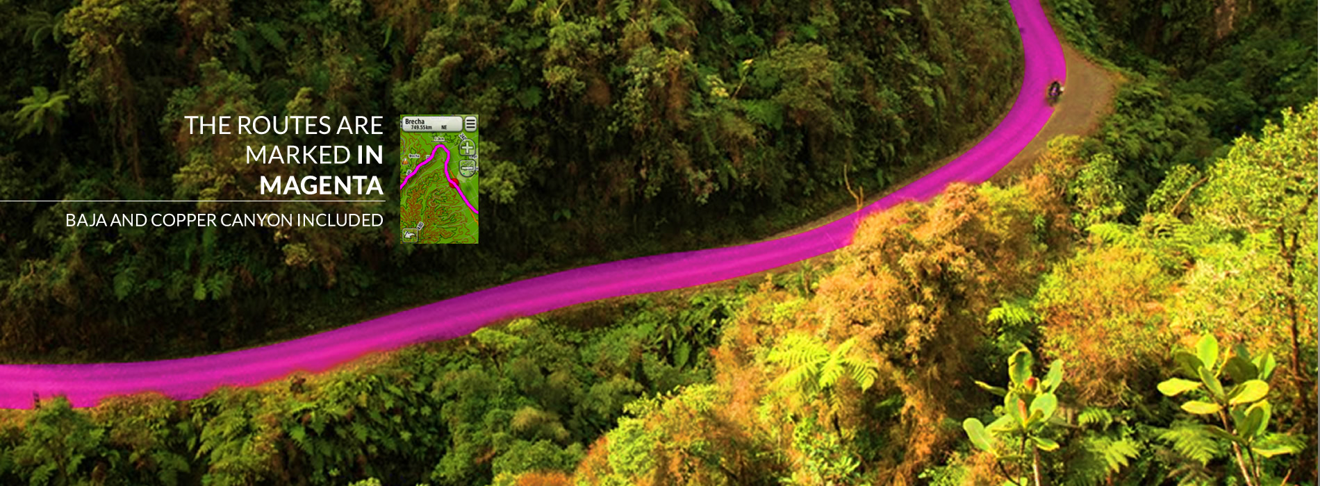
MAP E32 is perfect for the Baja 1000 race, or others such as the Baja 500 and San Felipe 250 in the Baja California peninsula, or other famous spots such as the Copper Canyon in Chihuahua.
COMPATIBLE
GARMIN GPS
MODELS WITH
MAP E32


The map contains around 30 routes for Baja.